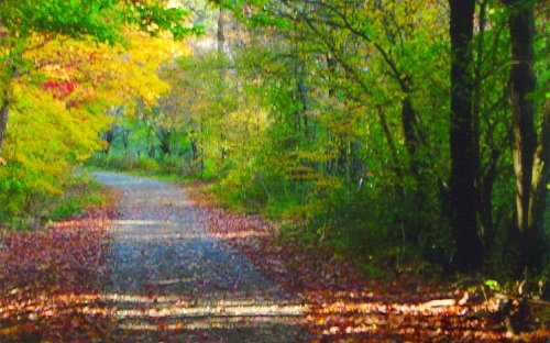
Old Chautauqua Road will lead you into the history of Cattaraugus County, as you travel from East to West across the County. This road was one of the first developed paths in the County. While the direct road no longer exists, Old Chautauqua Road is the name of the original path taken by the Holland Land Company after being developed to connect the holdings of that company that were to be sold. This guide will take you along a path over many renamed roads, while still trying to follow the original route of Old Chautauqua Road as closely as possible, as it was 200 years ago. Parts of the original road are no longer used, which will be noted, as new ones were added throughout the County.
History
Old Chautauqua Road was primitive, full of ruts and stumps and passed through dense forests. Some sections of the road were eventually abandoned such as Crandall Road. The early surveyor of the Old Chautauqua Road worked from an ox-drawn cart where they carried their food, supplies and belongings. Several ox teams were needed to drag the cut and fallen timber. Logs were hauled to construct bridges and the trail was made in as straight of line as possible, traveling over hills, valleys, forests and swamps. Inns and taverns were located within short disctances from each other as travel was hard and required frequent stops for rest, food and care for the animals.
The road, followed by early pioneers and drovers as they settled Cattaraugus and Chautauqua Counties, was built in sections. The Holland Land Company had given builders a mandate: the route connecting their holdings travels straight east and west would not deviate more than three degrees. Forests, swamps, hills, water and other obstacles challenged builders. This historic drive is separated into sections to represent the parts founded and the challenges faced when establishing the original route.
Section #1:
You will start out from the Northeast corner of the County at the intersection of 243, Hyuck Rd., and County Line Road. Five roads actually converge here as well as four towns and two counties. As you drive Southwards towards Farmersville on Hyuck Rd. notice how straight the road seems. Onto Kingsbury Hill Road the straight path continues, leading you into Franklinville and to a stop light. Cross over to Elm St. to see the first smaller building on the left. This was the site of Joseph McCluer’s log cabin and later a tavern. McCluer was a surveyor who was hired by Joseph Elliott and the Holland Land Company. He chose Bryant Hill Road as a main section of the Old Chautauqua Road.
Section #2:
Shortly after you leave Franklinville, the road will turn into Bakerstand Road and later you will have to go straight up the hill instead of curving to the right when the route follows Bryant Hill Rd. Take in the scenery around this area. You will see large horse farms and the Bryant Hill Cemetery, the resting place of early settlers. You will soon see a left hand turn onto Rt. 242 which will then take you into the quaint town of Ellicottville. There are many historic buildings located here, which you will learn about on the Rt. 219 driving tour.
Section #3:
Continue on Rt. 242. As you go up the big hill out of town, you will pass by a very old rundown structure that was once Fish Tavern, circa 1819. Settlers would stop to rest, eat and care for their animals. In this section, you will detour off the original route. At top of hill on Rt. 242, turn right on Windsor Rd. then follow to stop sign. Continue on Dublin Rd. and go to stop sign. Ahead is abandoned Crandall Rd. route which dead ends. The road through is now gone. You will instead turn left to remain on Dublin Rd. Dublin Rd. will meet up again with Rt. 242. Go straight and take Rt. 353 towards Little Valley. Once entering Little Valley, you will pass through town, then past Bicentennial Park. The park was dedicated on October 10th 1976 to coincide with the bicentennial celebration of Cattaraugus County. Shortly after you will pass the County Fairgrounds on your right as well. The Annual Fair has been held here in midsummer since 1842!
Section #4:
Take Rt. 353 to a left turn onto New Albion Rd. When you come to Pigeon Valley Rd., turn left onto it. Soon after you will pass Chautauqua Rd., but do not take as it is seasonal. At the next stop sign, turn right to stay on County Rd. 7, then turn right onto County Rd. 10. Turn left onto Chautauqua Rd. At this intersection was the Guy Tavern. This is no longer standing.
Section #5:
Continuing on County Rd. 10, will have you enter the Old Order Amish Country. Watch for buggies that you will see riding along on the roads in this area. This Amish one-room Schoolhouse reminds us of the days when all schools in the County were built in similar fashion. Please respect the religious beliefs of the Amish and refrain from taking photos of the people and note their shops are closed Sundays. Visit AmishTrail.com for the culture, maps, and information on our Amish communities. From County Rd. 10, you will come to a stop sign where you should proceed straight ahead onto County Rd. 40 (also called Seager Hill Rd). After coming down the large hill, just before the stop sign, you can find Rutledge Cemetery on your right.
The tour of Old Chautauqua Road will end at the next stop sign where County Rd. 40, Rt. 241 and Rt. 62 join. You are now almost to the border of Chautauqua County. From here you can reverse the tour and head back to Franklinville, continue on Rt. 62 North to Gowanda, or take Rt. 241 to Randolph.
Other Tours
View more historic tours around Cattaraugus County

